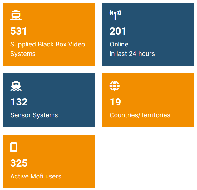
Over the past year, Anchor Lab has continued to grow, expanding our team, strengthening our capabilities, and deploying more than 80 new systems.Read More
22-07-2025
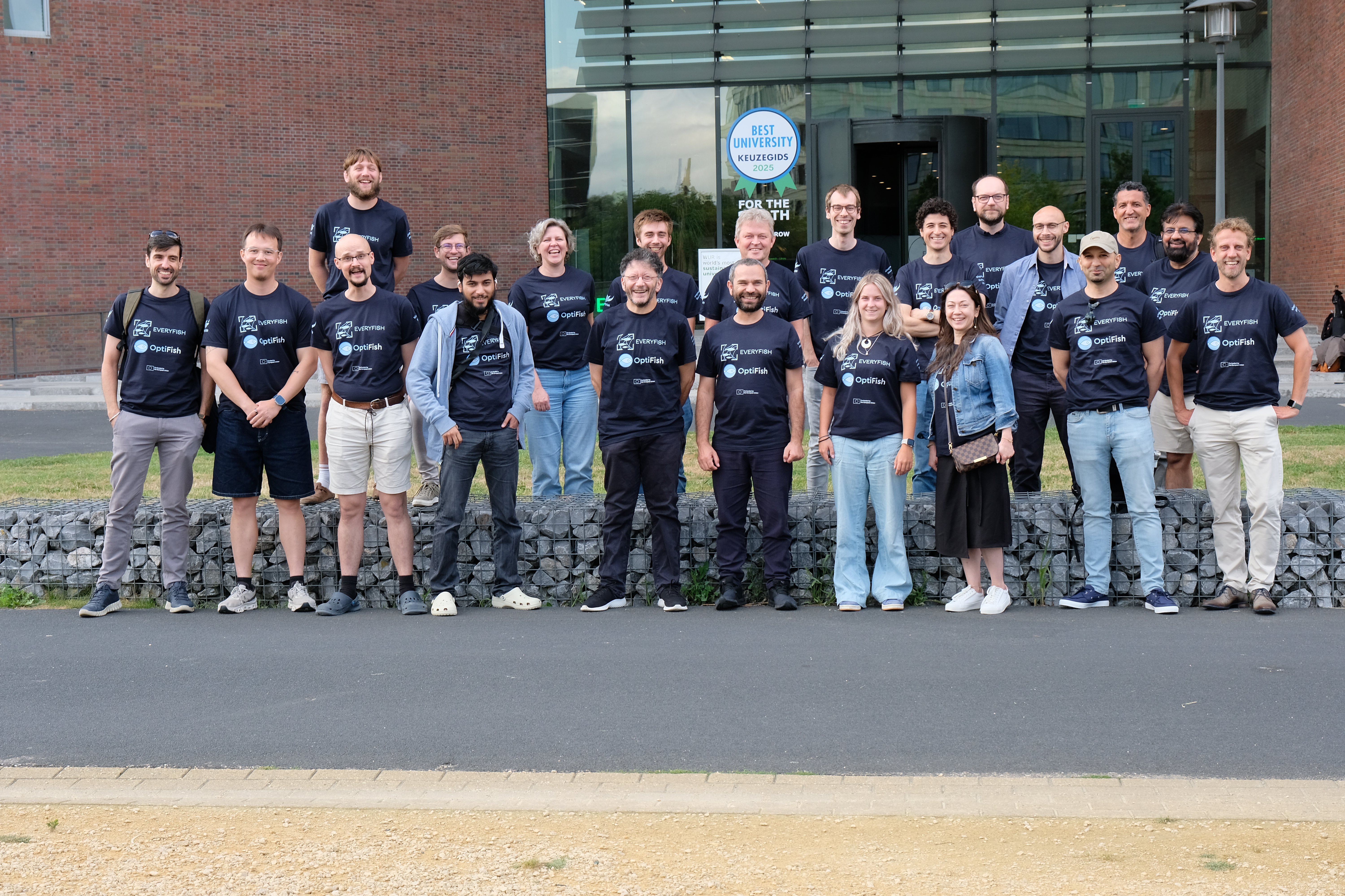
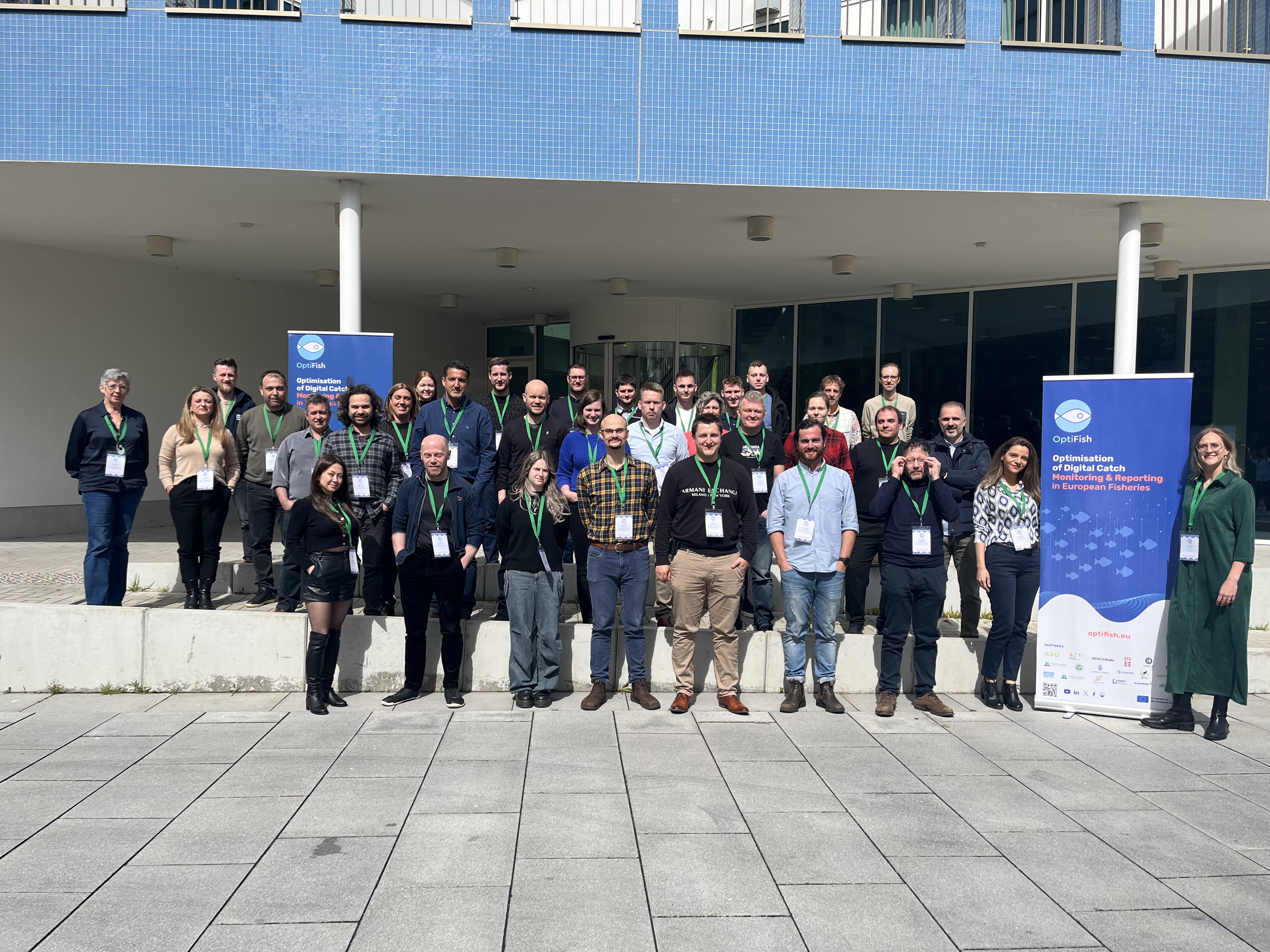
Optifish Hackathon in Wageningen, Netherlands
On the 7th of June, Wageningen University & Research hosted a week-long hackathon organized by the Optifish project in collaboration with the Everyfish project, two Horizon EU initiatives in which Anchor Lab is a partner. The event brought together an international team of scientists and students to advance the development of innovative AI solutions aimed at making fisheries more sustainable and automated.Read More
11-07-2025
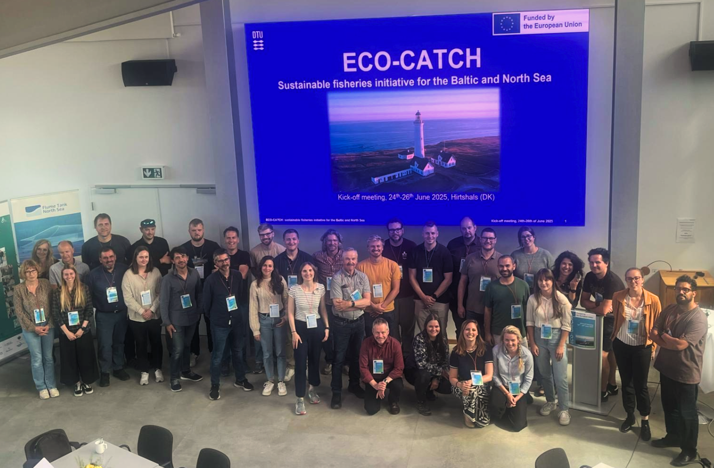
ECO-CATCH Kick-off Meeting in Hirtshals
We’re excited to be part of the newly launched EU project, ECO-CATCH! In the last week of June 2025, Anchor Lab attended the kick-off meeting hosted by DTU Aqua at their Hirtshals facilities.Read More
26-05-2025
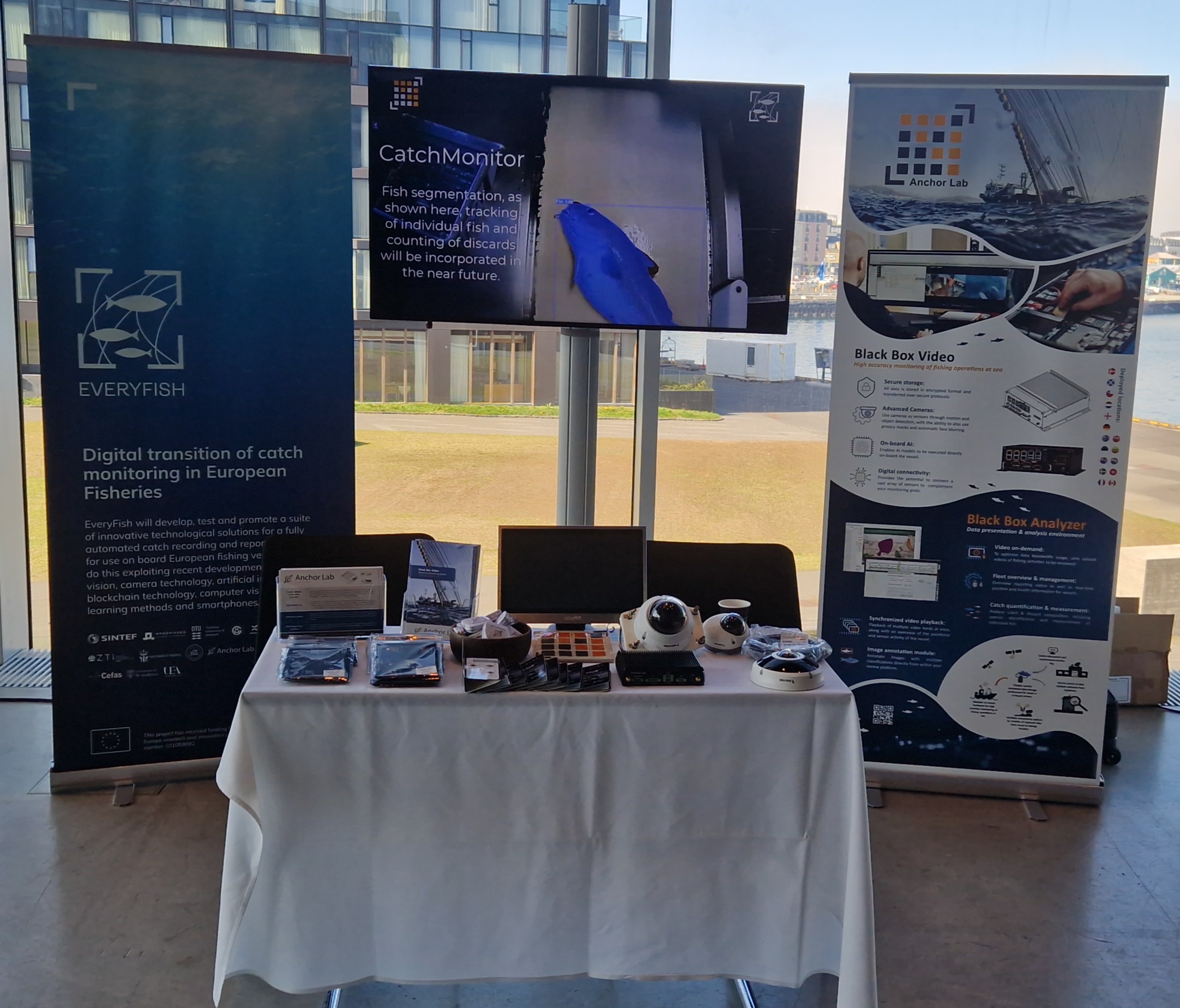
IFOMC 2025 - Reykjavík, Iceland
We attended the 11th International Fisheries Observer and Monitoring Conference (IFOMC) which was held in Reykjavík, Iceland, from 19th to 23rd of May. IFOMC is a leading event focused on enhancing effective fishery monitoring and supporting sustainable management of marine resources.Read More
17-02-2025
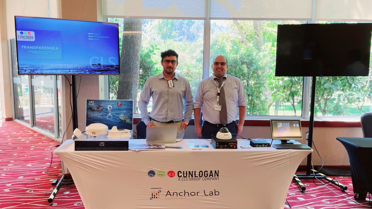
SPRFMO - Santiago, Chile
While Anchor Lab was unable to attend the SPRFMO (South Pacific Regional Fisheries Management Organisation) meeting in Santiago, Chile, we are thrilled that Cunlogan had the opportunity to present Anchor Lab’s Electronic Monitoring (EM) system. We appreciate the chance to contribute to the important discussions on the future of electronic fisheries monitoring.Read More
09-10-2024
REM Early Adopters
As the UK fisheries authorities gear up towards the adoption of Remote Electronic Monitoring (REM) within different fisheries. Anchor Lab is pleased to be assisting the English research and fisheries authorities in their initial roll-out of REM to early adopters.Read More
09-07-2024
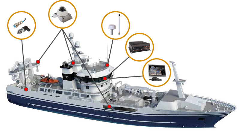
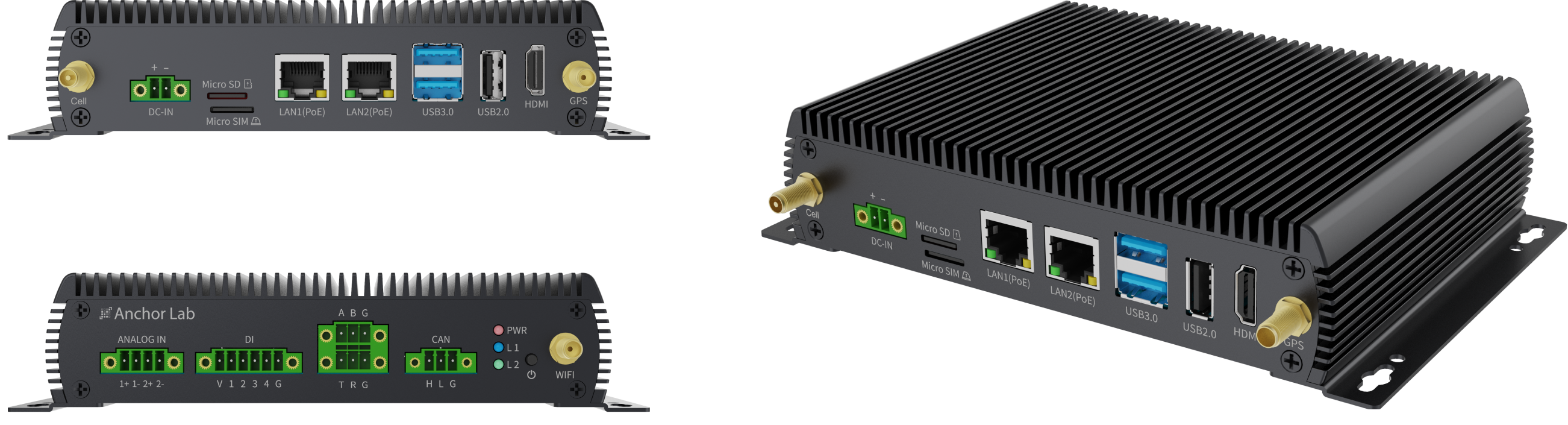
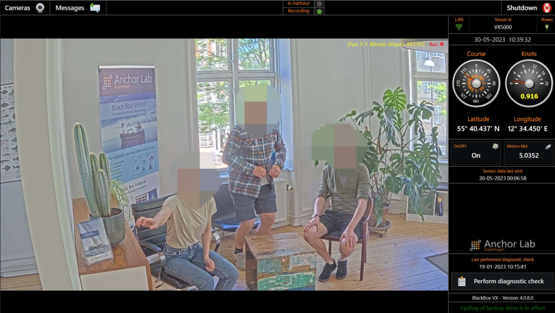
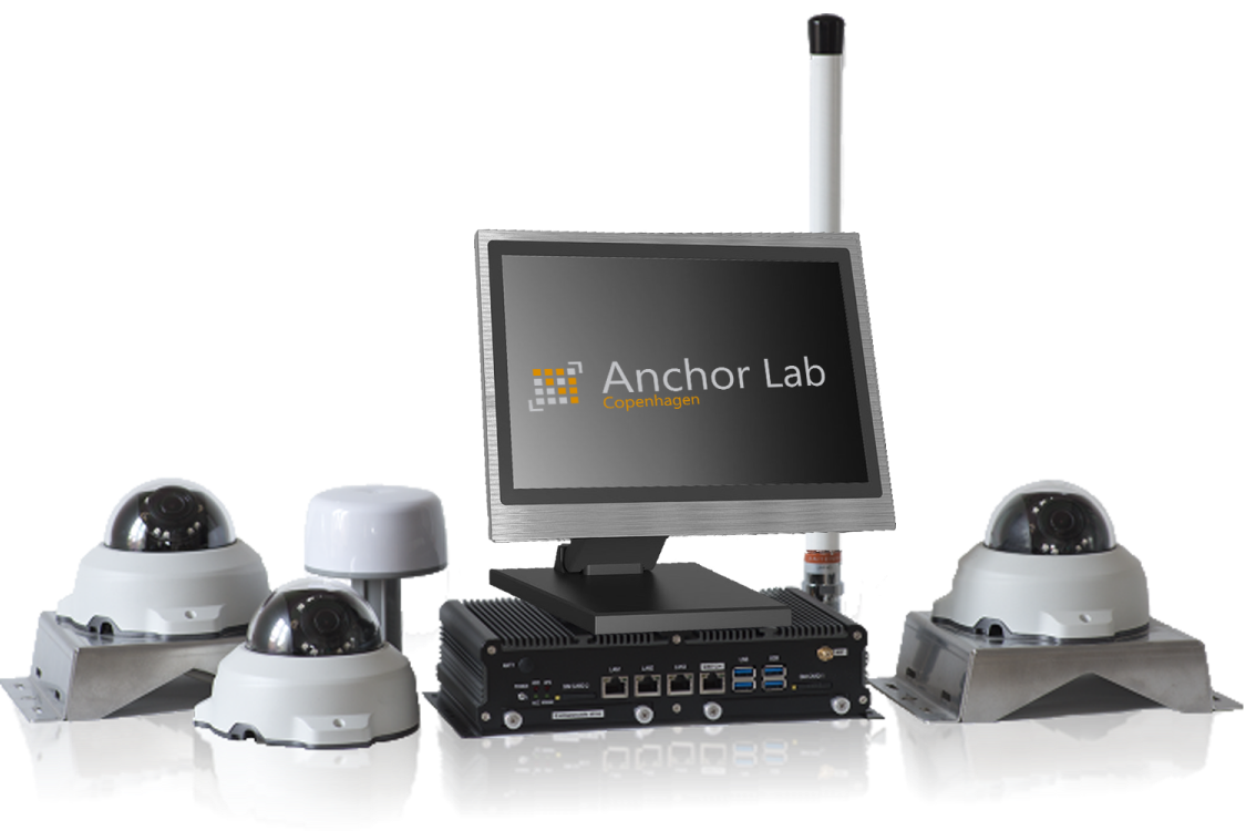
BlackBox VX Lite Released
Anchor Lab is excited to announce the launch of our latest remote electronic monitoring (REM) system, the BlackBox VX Lite. The control unit of the BlackBox VX Lite system has been custom-developed to Anchor Lab’s specific requirements. It is intended for use within the small-scale fisheries sector, with or without video capture enabled.Read More
26-06-2024
Over 500 EM Video Systems Supplied Worldwide
In the past couple of months, we have successfully shipped over 50 new EM video systems, pushing us past the significant milestone of 500 systems delivered to customers globally.Read More
18-04-2024
OptiFish Kick-off
We are excited to attend the kick-off meeting at ILVO’s Innovocean Campus, for the latest European Horizon project that we are participating in, OptiFish.Read More
28-02-2024
Everyfish progress update
The Horizon Europe project Everyfish is making good progress. Recently, the first annual meeting, hosted by ATZI, concluded in Bilbao.Read More
24-01-2024
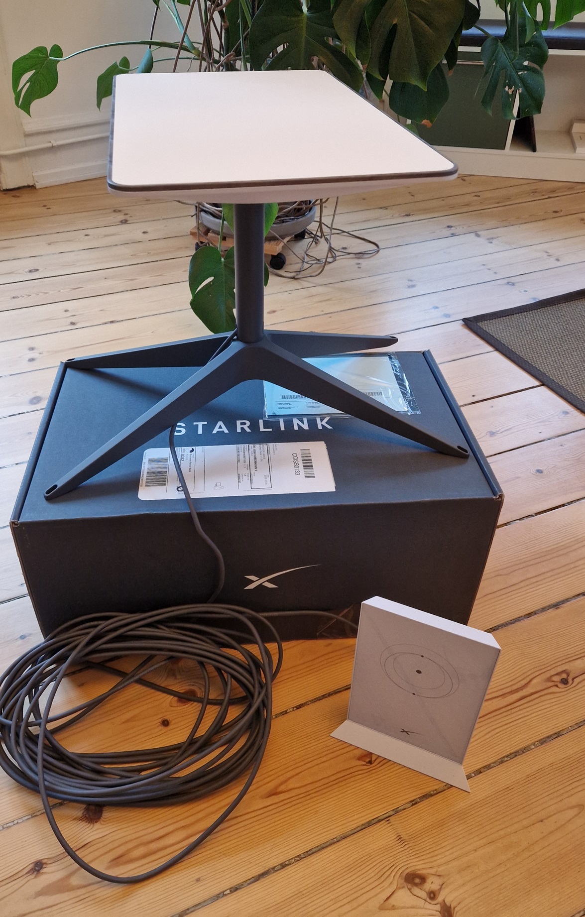
Starlink connectivity supported
We are excited to announce a new advancement. Our REM systems, designed to enhance monitoring and compliance efforts aboard fishing vessels, now offer seamless connectivity with Starlink internet.Read More
01-12-2023
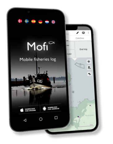
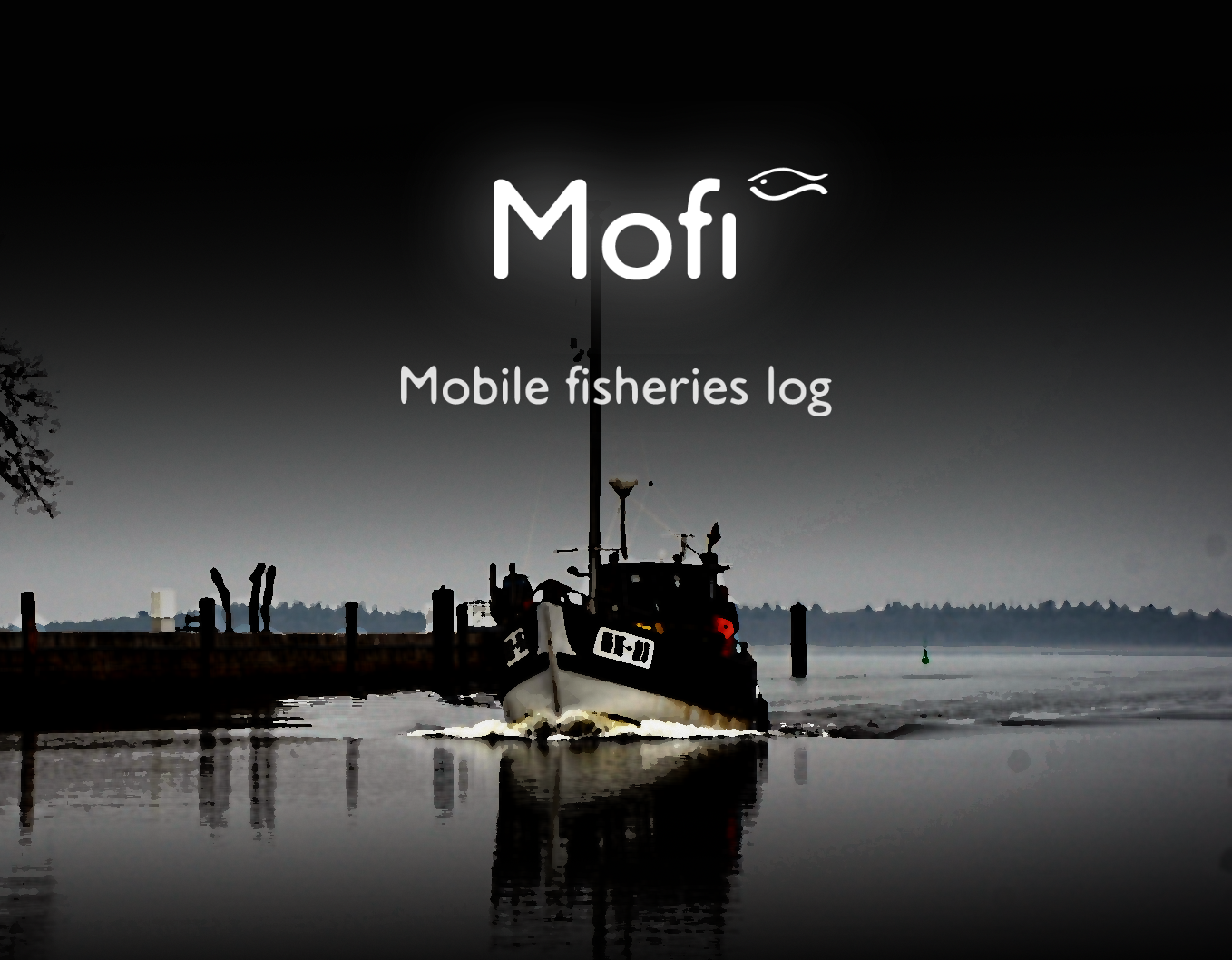
Mofi's Growing Impact in Fisheries Reporting
Mofi, the Mobile Fisheries App, has rapidly gained popularity with a user base exceeding 200 across Denmark, Germany, the Netherlands, and Sweden. Primarily used to streamline MSC reporting of protected species interactions, Mofi's user-friendly interface has sparked interest beyond its primary function, with fishers also utilizing it for efficient catch composition calculations.Read More
03-10-2023
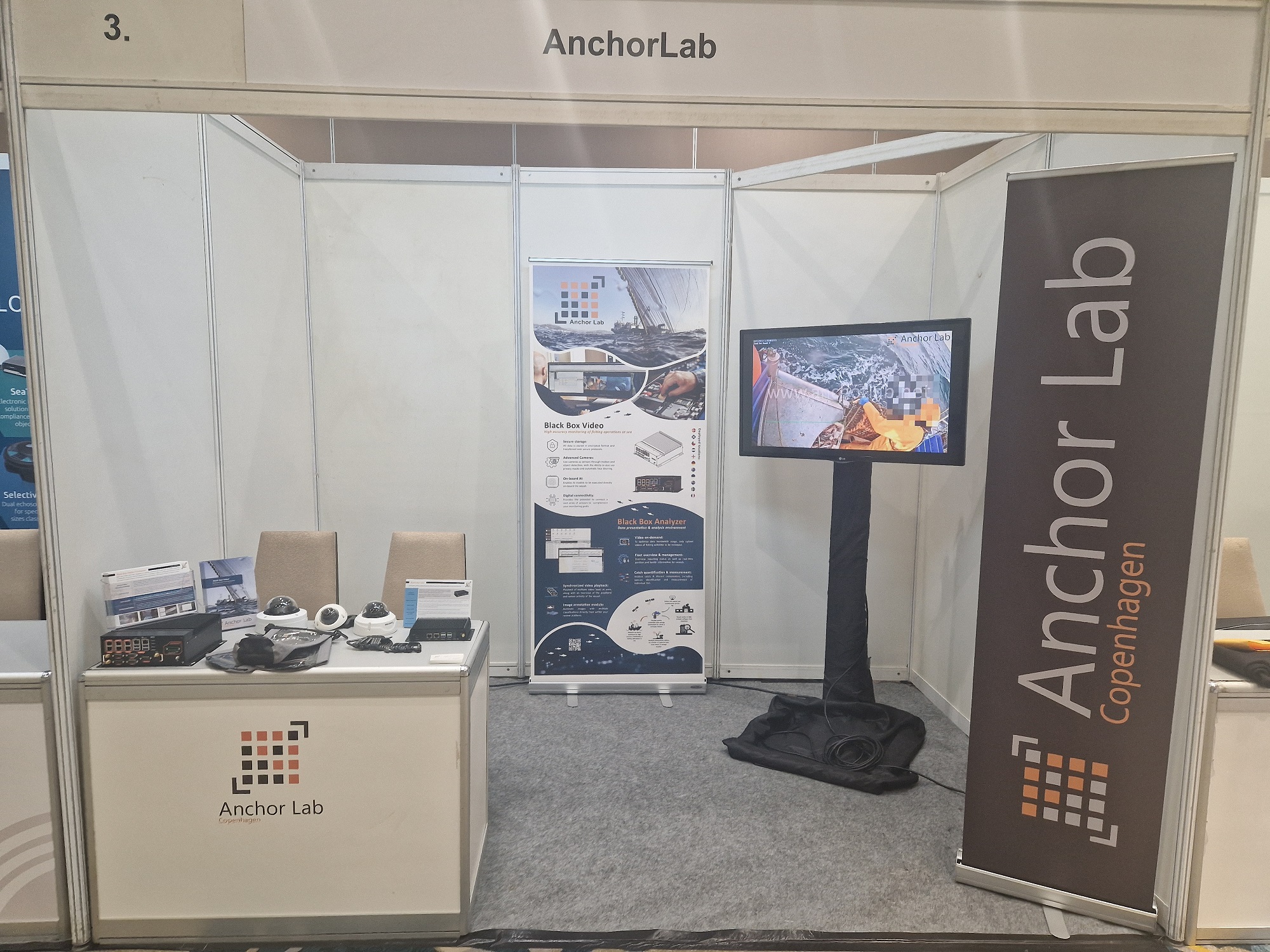
SAFET - Innovations in Electronic Monitoring and Electronic Reporting
Enjoyed the first day manning Anchor Lab’s exhibition stand at the SAFET Conference 2023. Already had many interesting conversations with conference attendees, and looking forward to two more action packed days of conference activities.Read More
14-08-2023
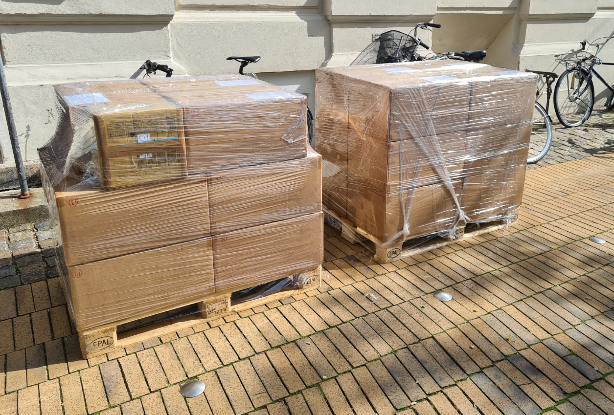
Systems ready for pick up
A nice sunny day to ship out some new systems. Twenty three (23) systems awaiting pick up.Read More
11-07-2023
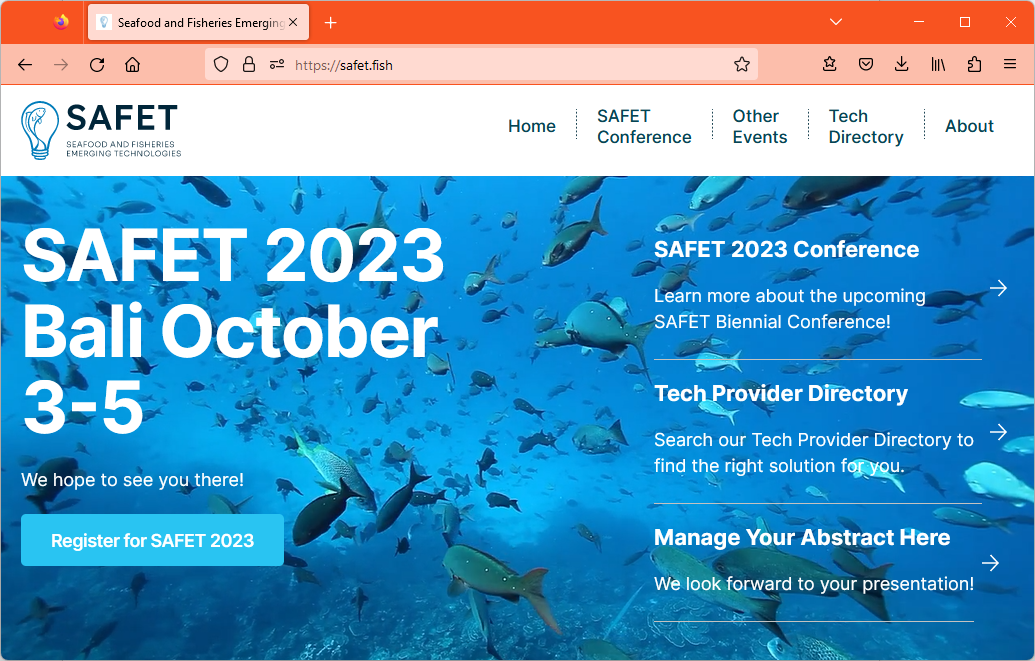
SAFET 2023
We are thrilled to announce our upcoming participation in the SAFET 2023 conference. As an exhibitor, we eagerly anticipate showcasing the latest advancements from Anchor Lab, including new products and latest developments in the field of AI. We are excited to meet and connect with all attendees who will be joining us at SAFET 2023 in Bali, Indonesia from October 3rd to 5th.Read More
31-05-2023
Revamped website goes live
Welcome to the newly released website of Anchor Lab! After years of development and growth, we have refreshed our online presence to reflect our journey and progress.Read More
21-03-2023
IFOMC Hobart
Anchor Lab proudly sponsored the 10th International Fisheries Observer and Monitoring Conference in Hobart.Read More
24-02-2023
Final preparations for IFOMC Hobart
We are putting the finishing touches to the material we will be taking to IFOMC Hobart. A conference that Anchor Lab is proud to be one of the sponsors of.Read More
21-02-2023
BlackBox VX Firmware 4.0.3 released
We have just released version 4.0.3 of the BlackBox VX firmware that brings additional privacy features, camera and sensor support plus much more to the firmware. The update will be downloaded and installed by the systems automatically, most likely when they are in harbour next. The main features included in the release are:Read More
06-02-2023
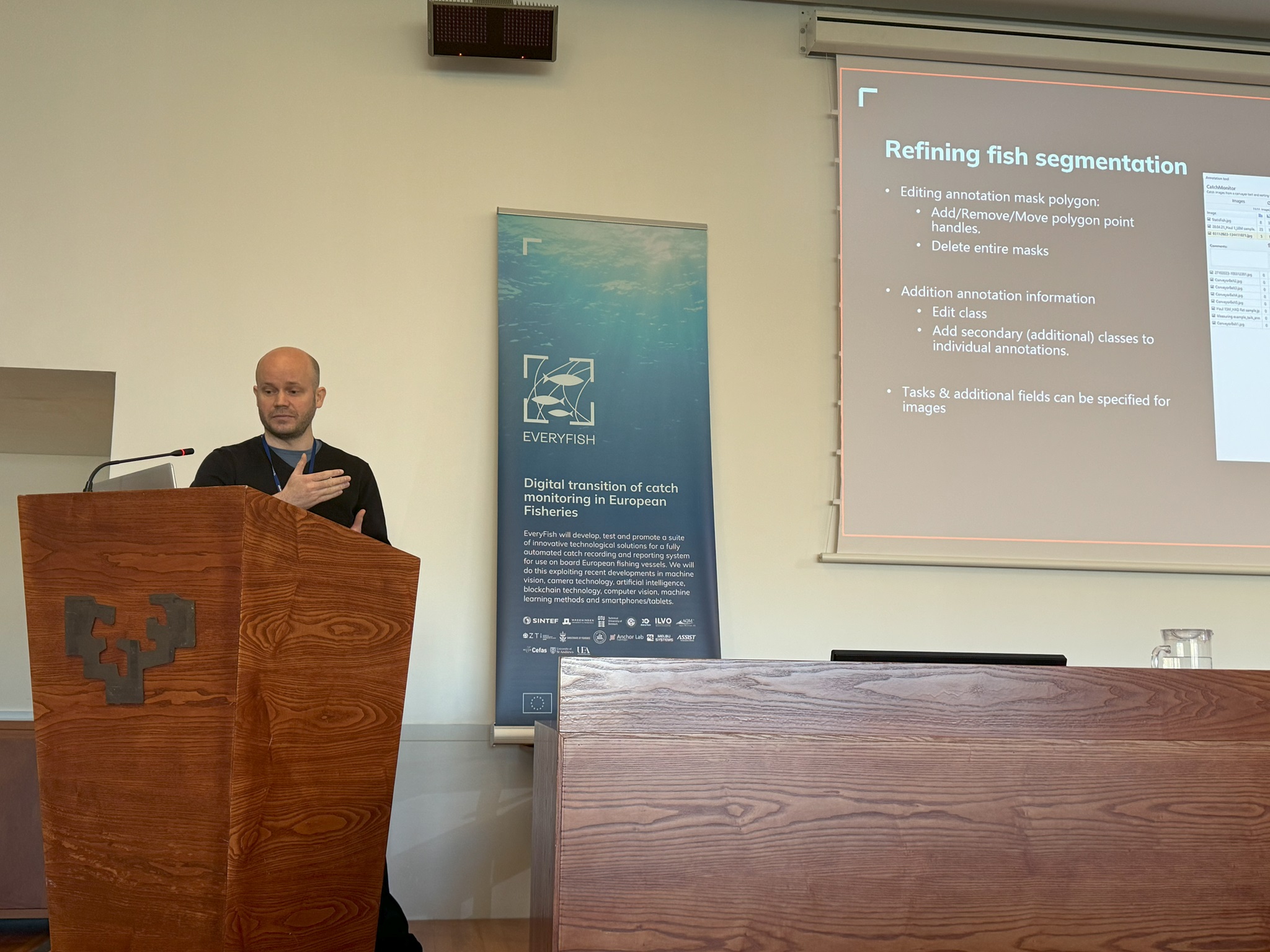
EveryFish kicks-off
EveryFish will develop, test, and promote a suite of innovative technological solutions for fully automated catch recording and reporting. The technological innovations will enable the sector to ensure correct reporting of the catch size, weight, and species composition.Read More
30-01-2023
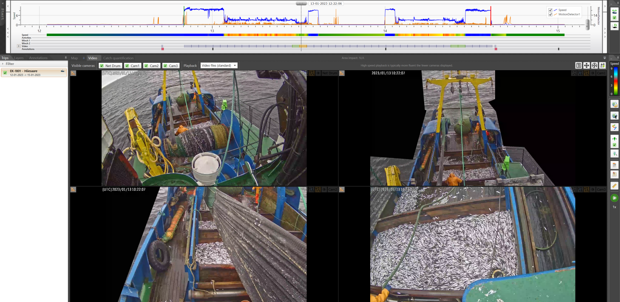
Estonian Environmental Board EM pilot project
AnchorLab – We are proud of being partners with Workboats Consulting involved in the fishing vessel video surveillance (CCTV) pilot project, which enables Estonian Environmental Board to monitor fishing-related activities with our specialized software. Our Black Box Video system has been successfully installed on three Estonian fishing vessels and it complies with all requirements. It is also verified by conventional monitoring methods and it shows our system is playing an important role when individual quotas are implemented.Read More
01-06-2021
BlackBox VX Firmware 3.4.42 released
We have just released version 3.4.42 of the BlackBox VX firmware that brings geofencing and motion detection to the table. The update will be downloaded and installed by the systems automatically, most likely when they are in harbour next. The main features included in the release are:Read More
31-10-2020
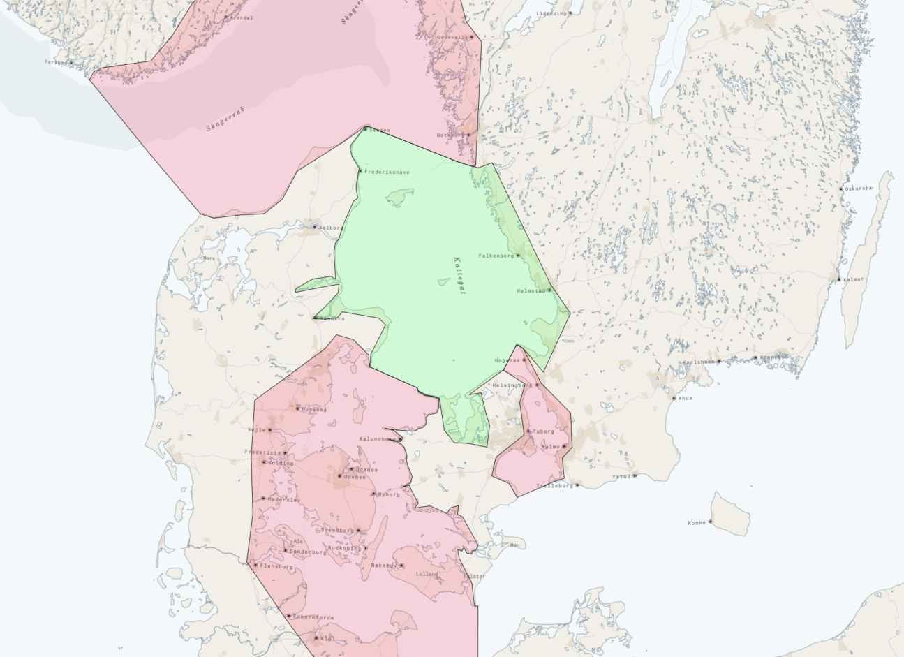
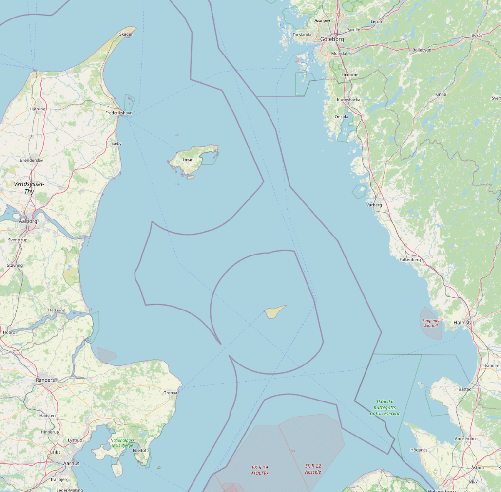
Kattegat rollout of electronic monitoring
Anchor Lab is rolling out electronic monitoring to the majority of the Danish bottom trawling vessels in Kattegat. It was politically decided to introduce electronic monitoring to the majority of the Danish fishery for vessels with bottom trawling gear.Read More
27-02-2020
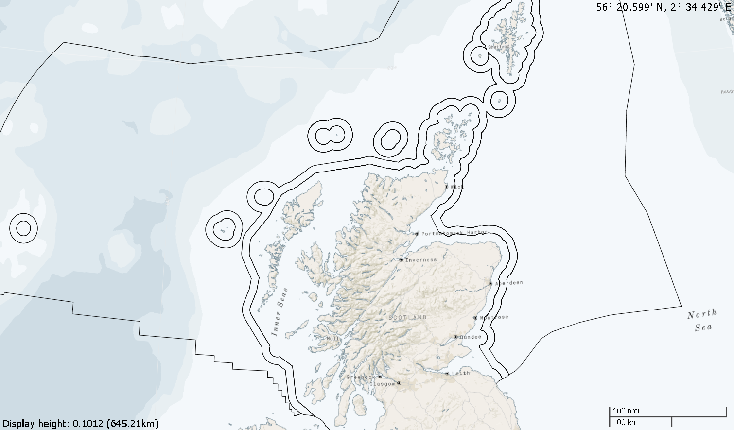
Anchor Lab is aiding the modernisation of Scotland’s inshore fisheries
The Scottish government has announced that electronic monitoring and tracking of vessels is part of a package of measures being taken to protect Scotland’s inshore fleet.Read More
18-02-2019
Queensland project moves forward to the proof of concept phase
We are extremely happy to announce that we are continuing our collaboration with the Advance Queensland Small Business Innovation Research Initiative and moving forward into the proof of concept phase.Read More
16-01-2019
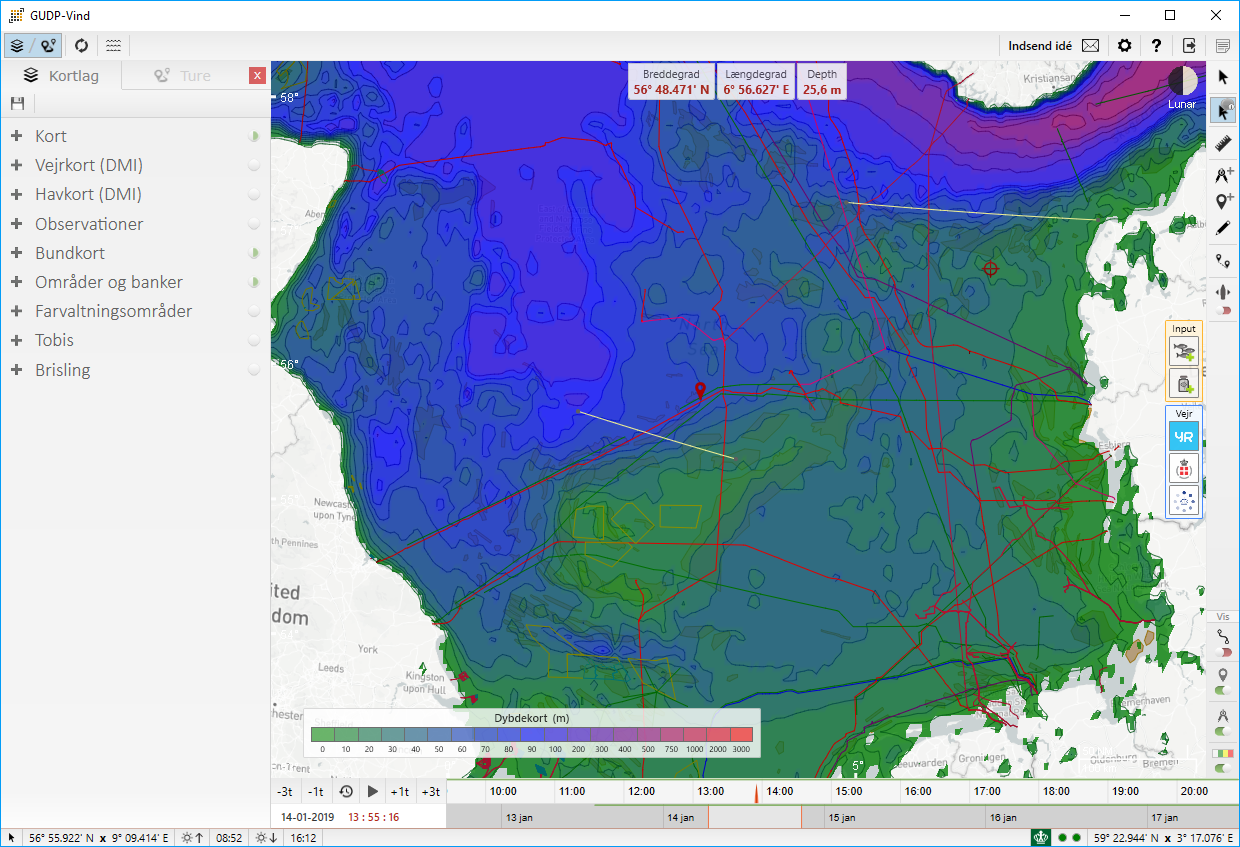
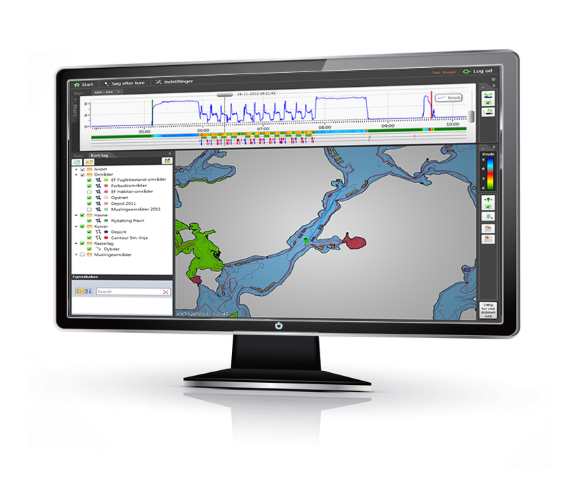
VIND version 2.4 has been released
VIND just got even better. We have optimized different areas of the application and reduced the size of all the dynamic layers. We even added some new bottom layers, providingRead More
12-04-2018
Small Business Innovation Research contract signed
We are extremely happy to announce that we have just signed a contract with the Advance Queensland Small Business Innovation Research Initiative to develop a new modular and flexible remote electronic monitoring system to enable a fully documented fishery.Read More
13-02-2018
Electrofishing for Razor Clams
We are pleased to be working closely with Marine Scotland to ensure the razor clam fishery off the west coast of Scotland is run in a sustainable manner.Read More
01-01-2018
Happy 2018, and thank you for your support in 2017!
2017 was an exciting year where Fishers got access to their own data collected by our Black Box systems. Where we entered the realm of artificial intelligence and applied machine learning techniques to our Black Box video streams. Where we expanded our portfolio with additional countries and rolled out systems in Scotland for compliance purposes.Read More
10-10-2017
Danfish 2017 - Ready to go
We have had a busy day setting up our booth at DanFish 2017. Meet us in Hall E at booth E456 and we will be happy to go over our latest developments.Read More
27-05-2017
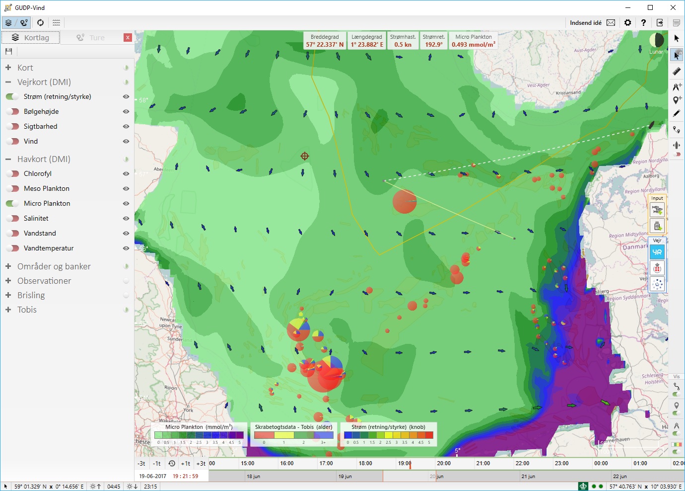
VIND version 2.0 has been released
Have you ever wanted to view the plankton, salinity or chlorophyl concentration and movement in the North Sea? Having a light weight nautical charts viewer (open sea maps) and plotter application? The new release of VIND gives you exactly that!Read More
22-04-2017
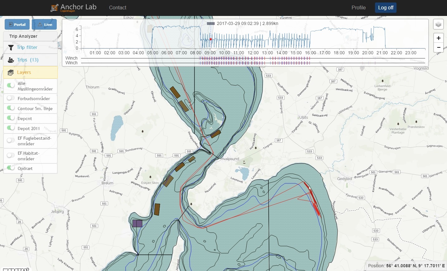
Fishermen now have access to their trips and area impact online.
We are excited to introduce Black Box Portal - a new user friendly web portal for fishermen to browse and analyze data collected from their Black Box system.Read More
01-03-2017
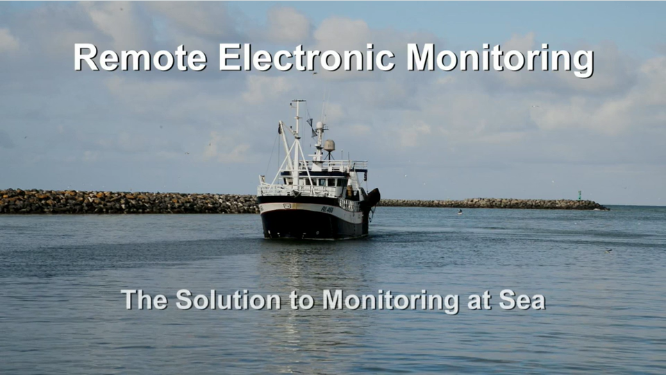
Video: It's difficult to manage anything if you don't measure it.
We would like to thank Funding Fish for being behind the creation of the following video explaining the details of remote electronic monitoring, the benefits, and the stakeholder perspective.Read More
15-02-2017
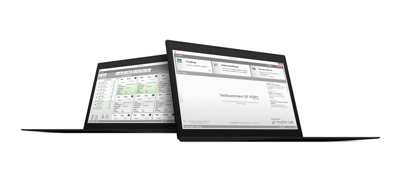
A new version of VDEC (1.9.5) has been released.
There has been a couple of changes to the traceabillity database SIF concerning its way of communicating and concerning the visibility of MSC stamped catches. The new release will therefore ensure that it is possible to send catch data to SIF in the future and that all MSC catches are visible to all relevant auctions and fish gathering stations. Read More
01-01-2017
Happy 2017! And thank you for your support in 2016.
2016 was an an amazing year where we turned 64-bit (Black Box Analyzer), entered the world of photogrammetry (measuring grid), fiddled with video compression (H.265) , and bettered the technological development within the industrial fishing industry (GUDP-VIND).Read More
05-10-2016
Black Box Video now supports H.265 video compression and Live View over a satellite connection.
We are happy to announce that our Black Box Video system now supports H.265 video compression reducing the compression bit rate with 40%-50% compared with H.264 at the sameRead More
12-07-2016
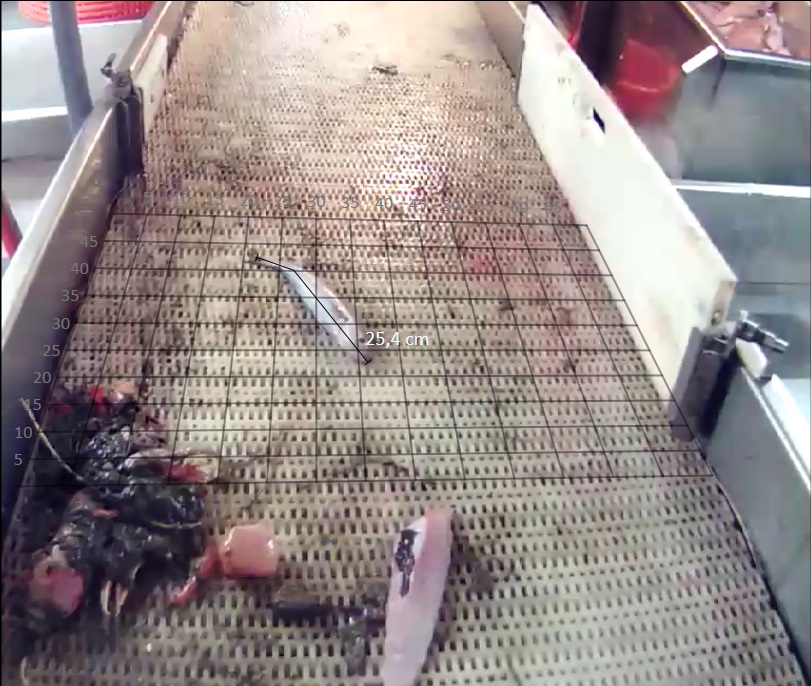
Black Box Analyzer now features Video On Demand and sharing of video measuring grids.
Black Box Analyzer 3.5 is out and is more customizable than ever with server synchronized user settings and the posibility of sharing video measuring grids with all users. The main features of the new release include:Read More
01-06-2016
Version 1.0 of VIND has been released
A new major release of VIND is out and ínclude many new exciting features:Read More
12-04-2016
A new release (1.9) of VDEC is out including discard registration capabilities
With the recent discard ban implemented in various european countries for a selection of species in specific areas, VDEC has been expanded with capabilities of directly inputting discard information in the application.Read More
10-03-2016
BlackBox Analyzer now features a highly capable measuring grid and a simple WEB API
A new build of our Analyzer software has been released featuring a new video overlay measuring grid component and a WEB API for accessing Analyzer data directly from 3rd party custom applications/scripts.Read More
10-02-2016
BlackBox Analyzer 3.0 is out and ships in both 32-bit and 64-bit
We are excited to announce that a new major version of BlackBox Analyzer is out that includes many new amazing features.Read More
15-10-2015
Enter sample data directly in VIND
A new release of VIND is out (version 0.7.2) enabling users to enter sample data and bycatch percentages directly through the application (eliminating the tedious paper schemas).Read More
01-09-2015
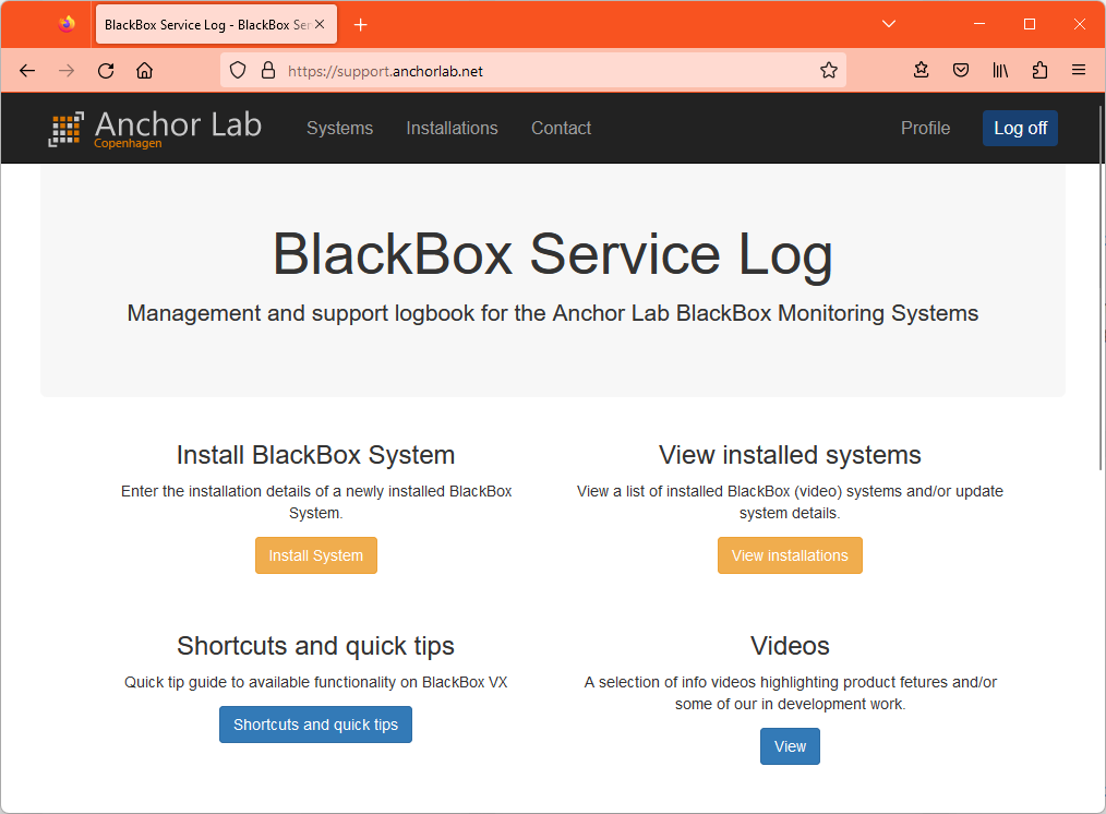
BlackBox Service Log is out in beta
It is now easier than ever to keep track of installed BlackBox systems by using our newly released BlackBox Service Log.Read More
20-06-2015
BlackBox Analyzer 2.0 has been released
A Major release of BlackBox Analyzer is out introducing many new and exciting features such as messaging and live view.Read More
27-04-2015
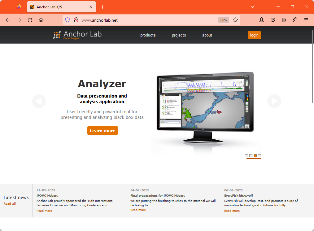
Our website just got better
We are excited to announce that our website is out with an updated design and an expanded product catalog. We added a whole new Electronic Monitoring section and included our Black Box Video System - the latest addition to the Black Box series.Read More
20-03-2015
GUDP-VIND alpha release
First release of VIND is now out and ready to be installed on the various fishing vessels. The release includes:Read More
05-02-2015
BlackBox Analyzer 1.5.0.2
Analyzer version 1.5.0.2 is released with many new and exciting features to the graph and to video playback.Read More
02-02-2015
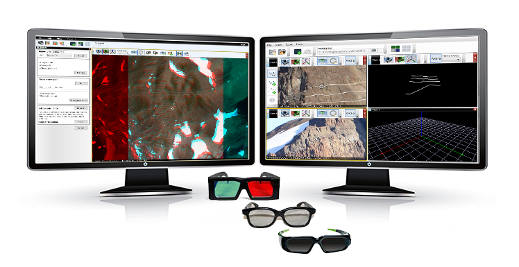
Major updates to 3D Stereo Blend
A new version of 3D Stereo Blend has been released with a refactored and enhanced guided orientation procedure and automatic project creation from flat Bingo files.Read More
01-01-2015
GUDP-VIND
We are happy to announce that the funding for the Danish development and demonstration project, GUDP-VIND, came through. Anchor Lab is therefore teaming up with DTU Aqua, DMI, DFPO and, DPPO to expand and enrich the technological development within the industrial fishery industry with innovative dynamic digital maps.Read More